Catégorie : Mobilité

  • Développer des outils numériques pour stimuler les changements de comportements

    Développer des outils numériques pour stimuler les changements de comportements

    L’accélération des transitions est un mantra que l’on retrouve au cœur des agendas industriels et institutionnels : énergie, environnement, RSE… In fine ce sont de nouveaux usages qui sont attendus pour changer les paradigmes actuels. Les briques élémentaires sont bien souvent disponibles, il faut les mettre en musique et générer de l’adhésion, à grande échelle. Le développement de mécanismes centrés sur l’incitation est une nécessité pour libérer les frictions inhérentes à l’éclosion de nouveaux modèles, économiques et organisationnels.

    Traiter les défis sociétaux à travers les mécanismes classiques de notre économie est un pari de longue haleine : contraintes légales, réglementaires ou fiscales, business, marketing, tissu associatif… Promouvoir de nouvelles trajectoires peut aussi passer par l’émergence de modèles économiques étendus au sein des chaînes de valeur, adossés à des enjeux stratégiques portés par l’ensemble des parties prenantes. La technologie ne saurait constituer le levier unique pour répondre à ces challenges, l’adoption de solutions à impact en est une clef. Ce sont les usages de masse qui dimensionnent les retombées.

    En France la fiscalité liée aux émissions carbone est aujourd’hui principalement portée par la TICPE (taxe intérieure de consommation sur les produits énergétiques), dont l’assiette se réduit à mesure que la consommation de produit pétroliers diminue. En parallèle on ne constate pas -à date- de résultats notables sur la décarbonation de notre économie. D’une part parce que seuls 20 % du produit de cette taxe sont fléchés vers la « transition énergétique », d’autre part parce qu’une partie des entreprises en sont exonérées.

    Comment distinguer les initiatives qui contribuent réellement aux défis qu’elles adressent de celles qui prétendent le faire ? Le contexte appelle à une plus grande efficacité des démarches, sans pour autant brimer l’innovation et les initiatives à petites échelles. Comment impliquer plus largement les opérateurs de services, consommateurs, fournisseurs et autres parties prenantes des chaînes de valeur pour développer des approches qui combinent pédagogie, efficacité opérationnelle, utilité et soutenabilité financière ?

    Élaborer et orchestrer des trajectoires lisibles

    Ces défis de société impliquent d’élaborer des visions long-terme et de projeter -au moins temporairement- certains critères de rentabilité à un niveau global au lieu de vouloir forcer l’optimisation de sous-systèmes qui sont interdépendants. Cette approche systémique constitue le socle d’une démarche fondamentalement collaborative.

    La RSE est définit comme « la responsabilité des entreprises vis-à-vis des effets qu’elles exercent sur la société » par la Commission Européenne. Ces évolutions structurelles créent des interfaces entre les entreprises et la société, et placent de fait les dirigeants dans des positions qui les amènent à étendre le champ de leurs responsabilités. Les tendances concourant à la normalisation des indicateurs extra-financiers et l’obligation de reporting vont de fait exposer les pratiques en vigueur au sein des entreprises. Ce cadre porte un fort potentiel d’innovation qui peut permettre d’impulser des initiatives qui permettraient d’agréger des consortiums d’acteurs économiques autour de ces objectifs.

    Pour fixer des objectifs, il convient de s’entendre sur une origine. C’est sur la base de situations de référence calibrées que des évolutions pourront être mesurées, et les trajectoires évaluées. La fusion de données issues de services numériques avec des données statistiques et des données ouvertes doit contribuer à analyser et quantifier les niveaux d’adoption et leur progrès. De même les impacts générés doivent être caractérisés et mesurables à tous les niveaux de la chaîne de valeur : réduction de l’empreinte environnementale, amélioration de la résilience ou de la circularité. Ces notions parfois prosaïques seront converties en indicateurs intelligibles pour chaque contributeur. Pondérer la part de l’individuel et l’action globale du collectif permet de maintenir le sens de la démarche, en impliquant l’ensemble des échelons avec un niveau de responsabilité adapté.

    Promouvoir des modèles coopératifs plutôt que coercitifs

    La transformation numérique des entreprises et des territoires passera aussi par l’émergences de nouvelles méthodes de coopération à fort impact sur leur secteur. Au sein de chaîne de valeur établies ou naissantes, des alliances novatrices peuvent conduire à réviser des modèles figés.

    Passer des changements de comportement à l’échelle implique d’enrôler largement opérateurs, fournisseurs et usagers. Les communautés constituent des viviers d’initiatives, quand cela est pertinent elles doivent pouvoir être soutenues dans leurs besoins d’opérationnalité. Amplifier des phénomènes émergents pour tester et valider leur contribution aux objectifs globaux et identifier les facteurs de réplication doit permettre de tenir compte des spécificités contextuelles. Les réflexions systémiques autour des défis sociétaux doivent pouvoir être déclinées à des échelles réduites.

    L’essor du véhicule électrique constitue un enjeu de décarbonation important et le passage à grande échelle polarise des questionnements autour de la production énergétique en omettant parfois la concrète mise en application. Ainsi en zones urbaines et périurbaines l’électrification ne peut être dissocié d’une nécessaire réduction du nombre de véhicules en circulation, ce point pouvant être satisfait par des services de covoiturage. En complément le coût de possession de ces véhicules et les contraintes liées à la recharge plaident pour la concrétisation de modalités de partage de la ressource, autant infrastructurelle (l’espace publique de circulation et de parking, les points de recharge) que matériel (les véhicules). Les tensions prévisibles sur les usages et la gestion de l’espace publique appellent à la conception d’outils qui permettront de combiner au mieux le développement de nouvelles pratiques avec des politiques de mobilité et des services rentables.

    La création d’outils dédiés à la stimulation de comportements représente un champ à développer, à la convergence du nudging, du marketing et de la conduite du changement. Articulés autour de la notion de preuve d’usage, ils doivent permettre de faire circuler des informations certifiées au sein d’une communauté. Ces outils doivent lever des verrous autour de la gestion de l’identité, et ce afin de pouvoir mettre en œuvre des mesures ciblées aux effets intensifiés. Au cœur de ces dispositifs, la possibilité de paramétrer et piloter des campagnes d’incitation focalisées, quantifiées et ajustables dans la durée. La modulation des mesures en intensité et périmètre fondera l’agilité nécessaire pour catalyser de nouveaux modèles économiques.


    Références :

    Ademe : Découvrez l’impact sur le climat des objets et gestes de votre quotidien

    https://impactco2.fr/


    TDIE – Engagements climatiques et mobilités : à la recherche du bien commun

    https://tdie.eu/storage/2023/01/Note_CS_TDIE_climat-mob_bien_commun_16_01_2023_V_num.pdf


    La responsabilité sociétale des entreprises – Ministère de la Transition Ecologique

    https://www.ecologie.gouv.fr/responsabilite-societale-des-entreprises


    « Le reporting extra-financier va devenir une science de la donnée et une industrie de la vérification »

    https://www.lemonde.fr/idees/article/2022/12/05/le-reporting-extra-financier-va-devenir-une-science-de-la-donnee-et-une-industrie-de-la-verification_6153031_3232.html

     

  • Transition numérique des mobilités et de la logistique : quel rôle pour les territoires ?

    Transition numérique des mobilités et de la logistique : quel rôle pour les territoires ?

    Le chantier de la transformation numérique des transports pourrait sembler clôt, il n’a atteint qu’une phase intermédiaire. Cette étape aura vu émerger un ensemble de mutations technologiques qui ont concrètement marqué le secteur. Les autorités organisatrices de la mobilité doivent maintenant s’appuyer sur de nouveaux outils, notamment d’aide à la décision, leur permettant de créer les conditions d’une mutation efficace des pratiques.


    Un premier chapitre de digitalisation structurelle

    Durant les quinze dernières années, les territoires auront assimilé une série de mutations liées à l’essor des technologies numériques au sein des secteurs mobilité et logistique : calculs d’itinéraires multimodaux, émergence d’opérateurs tiers, création d’offres en libre-service, intégration des services dans les smartphones, crowdsourcing, billettique interopérable, essor du e-commerce et des livraisons à domicile.

    Localement, nombre d’évolutions sont subies, telles que la réduction de la demande (et des recettes) suite aux épisodes sanitaires et au développement du télétravail, ou la plateformisation des services. La multiplicité des offres et des opérateurs privés a contribué à sensibiliser les usagers et accroître leur niveau d’exigence sur l’information, la tarification et globalement la notion de qualité de service.

    Les collectivités ont historiquement mis en œuvre un ensemble de stratégies d’aménagement du territoire qui tendent à complexifier les schémas de mobilité. Ainsi l’étalement urbain contribue à diffuser la demande, alors que les articulations entre modes individuels et collectifs ont souvent été négligées, et que les modèles contractuels en vigueur sont difficilement synchronisables avec les évolutions du marché. De même la résilience des infrastructures ne peut être négligée face à la dynamique des services numériques.

    Le contexte est néanmoins encourageant et stimulant pour relever de nouveaux défis. Les agendas politiques devraient s’aligner avec la montée d’une conscience collective appelant à des pratiques plus éco-responsables. L’évolution du mix énergétique pour les mobilités se concrétise pendant que l’écosystème s’étend autour d’acteurs et de propositions de valeur alternatives. Articulé autour de briques technologiques numériques, l’ensemble de ces contributions doit pouvoir être coordonné et projeté pour transformer le secteur et notamment les usages.

    Une nouvelle transformation numérique opérationnelle

    Les mobilités et la logistique sont les composantes d’une économie de marché. Elles sont qualifiées en termes de niveau de service, de coût, mais aussi au regard de leur taux de pénétration et de leur contribution environnementale.

    Les challenges auxquels font face les territoires sur ce champ croisent plusieurs objectifs et moyens. La décarbonation est le défi sociétal transverse qui servira d’étalon pour définir les objectifs et mesurer les progressions. Cette notion doit être quantifiée, pondérée et d’une certaine façon instrumentée pour supporter l’analyse des trajectoires. Les capacités d’observation des systèmes de mobilité doivent être étendus pour approfondir leur étude, consolider une vision réellement multimodale des pratiques et intégrer la logistique.

    L’optimisation est une démarche de rationalisation qui contribue à la sobriété. Pour engager plutôt que contraindre -par exemple dans la réduction de la part modale des véhicules individuels- il faut pouvoir identifier des potentialités, et les exploiter. Massifier les flux de personnes et de biens est un enjeu considérable, notamment à infrastructure constante. Les alternatives aux pratiques actuelles doivent être crédibles, aussi bien fonctionnellement qu’économiquement.

    Enfin, la digitalisation représente un ensemble de moyens permettant d’augmenter les capacités, mais aussi d’engager plus largement autour d’une même démarche les opérateurs, fournisseurs, usagers et  clients. Ce potentiel d’agrégation est combiné à une capacité de ciblage. Différencier les pratiques et  les usagers doit permettre de mettre en œuvre des stratégies mieux adaptées aux effets de leviers plus importants. De plus, certaines perspectives méritent d’être remises en lumière, ainsi le déploiement commercial des véhicules individuels connectés ouvre un champ de valorisation très prometteur.

    Après une phase de foisonnement d’usages, de technologies, et la consolidation d’un secteur, le second temps de la digitalisation devra être celui de la stratégie. Les collectivités et l’État devront engager opérateurs, fournisseurs de services et citoyens autour de démarches claires, objectivées et mesurables. Ce temps d’action permettra d’aligner enjeux collectifs et perspectives individuelles. En ce sens le MaaS (Mobility as a Service) vise à optimiser l’interconnexion des services et constitue une brique de la démarche. Pour tirer parti de ce potentiel technique il faut l’adosser à des capacités d’analyse et d’aide à la décision qui incarnent l’étendue des systèmes de mobilité et de logistiques actuels.

    Des outils d’aide à la décision et des verrous technologiques

    La digitalisation des mobilités a imposé un contexte plus protéiforme, plus intriqué et plus complexe, au sein duquel les collectivités doivent ajuster leurs modalités d’intervention. Embrasser cette complexité sans la minorer et éclairer chaque étape des processus de pilotage contribueront à valider la cohérence et l’acceptabilité des futures orientations politiques.

    Ces objectifs représentent une série de missions territoriales dont la mise en œuvre courante doit être dépassée pour répondre aux enjeux de décarbonation, d’optimisation de l’existant et de maîtrise des coûts. Il existe cependant une corrélation entre ces actions et un ensemble de verrous scientifiques et techniques, qui font l’objet de travaux au sein de l’IRT SystemX :

    • Étendre la connaissance des pratiques de logistique et de mobilité passera par l’intégration de données d’exploitation et/ou de véhicules connectés. Ces contenus sensibles -au titre de l’activité économique ou du RGPD- ne pourront être hébergés et anonymisés que dans des environnements de confiance qui permettront aux producteurs privés de dégager une valeur ajoutée suite à leur contribution.
    • Explorer des scénarios aux variables multiples, évaluer différents paramètres pour comprendre le champ des possibles et identifier les trajectoires souhaitables requiert des outils de modélisation avancés. Ces outils sont parfois opérationnels pour la recherche, ils devront être démocratisés pour supporter des usages industriels.
    • La planification des infrastructures et des services de mobilité doit être abordée à des échelles qui dépassent souvent celle de l’autorité organisatrice de la mobilité (AOM) en charge. Décarbonées, les mobilités requièrent aussi une orchestration avec les réseaux d’alimentation en énergies. Les plateformes de simulation devront être augmentées pour supporter les approches multi-échelles.
    • L’évolution des pratiques à grande échelle passera par la conduite du changement en complément de dispositifs réglementaires ou coercitifs. Le ciblage des usages et la mise en œuvre de stratégies d’incitation susceptibles de générer des effets de levier importants permettront aux collectivités d’animer l’écosystème de la mobilité dans sa transition.
    • La multiplicité des phénomènes aux évolutions rapides impose de réformer les protocoles d’évaluation. L’obsolescence des pratiques et des données est accélérée, de même que certains épiphénomènes présentent des impacts marqués. L’approche dite de « jumeau numérique » simule les composants des systèmes mobilité et logistique, en ayant notamment pour objet de retranscrire leurs dynamiques.
    Piloter les mobilités et la logistique digitalisées : corrélation entre les besoins territoriaux et des verrous technologiques structurants

    Dans un contexte multi-partenarial étendu et face au défi d’une décarbonation qui sera aussi décentralisée, le rôle de stratège et d’animateur des territoires est renforcé. L’essor des solutions numériques ouvre un spectre de possibilités et multiplie les scénarios. Face à cette complexité le développement d’une vision quantifiée, pilotable et ajustable requiert pour l’écosystème de la mobilité et de la logistique de nouveaux outils numériques. L’ampleur des enjeux impose un cadre d’innovation collaboratif au sein duquel les collectivités ont un rôle important à jouer.

  • The future of urban deliveries with robots

    The future of urban deliveries with robots

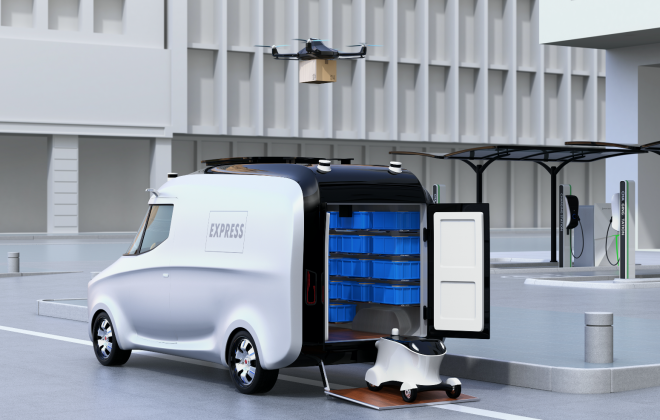
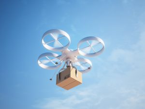
    In recent years we have seen an increase of experimentations with drones and robots for last-mile deliveries. There are experimentations with drones for deliveries in suburban or rural areas based at specific drone ports[1]. Others are experimenting with van based drones for increased efficiency when delivering goods in areas where delivery points are further apart than in highly urbanized settings[2]. Other experiments are performed using robots for deliveries, one of the first robot delivery use cases was pizza delivery[3]. In urban, settings autonomous deliveries are becoming an increasingly important topic with significant investments looming but also with major regulatory subjects to address[4]. 

    If we examine the different possible use cases for robot and drone deliveries, we quickly realize that a significant use of drones is not to be expected soon in densely populated areas, however slow driving robots become an interesting alternative in settings with restricted access for vans and cars as they are usually smaller, slower, quieter, and cleaner than car or scooter based deliveries. Several experiments have been performed on campuses and pedestrianized areas[5]. It seems that in the future we will see a lot more of these experiments as the promise of increasing efficiency and reducing cost by not needing delivery personnel is attractive to many companies. Just very recently a new fast food truck has been tested in Shanghai permitting some sophisticated interaction with the robotic delivery vehicle: Clients can choose and pay their food directly at the vehicle[6].
    These very exciting technological developments raised interest in the Anthropolis chair’s team. It made us think about the operational possibilities and implications of such a technology. In a recently defended PhD thesis[7], PhD student Shoahua Yu investigated various operational aspects related to robotic deliveries. The main idea was to look at “mothership” variants of the problem.

    • First, two-echelon urban deliveries using robots for 2nd-level route delivery were considered. In this concept, the mothership van carries robots on the 1st-level route and drops them off and picks them up at rendezvous nodes, while the robots handles deliveries on the 2nd-level routes. In this first version, only robots are able to deliver to customers. Our target areas are pedestrianized zones in city centers or campuses. We proposed mathematical models to simulate various test cases and performed a sensitivity analysis for vehicle speed combinations revealing that increasing robot speeds has only very limited benefits. We therefore recommend to keep robot speeds rather low for a pedestrian-friendly insertion into the urban environment.
    • As we considered battery powered robots and vans, we extended our models to incorporate range restrictions and recharging operations for vans and robots. We allowed robots to be recharged in the vans during recharging stops but also en-route. A sensitivity analysis for vehicle charging modes, maximum battery capacities, and charging rate shows that using en-route charging while increasing battery level and charging rate can have beneficial effects on operational costs.
    • We finally considered a very general problem variant where robots and vans are performing pickup and delivery operations in city. Robots can visit areas with van access restrictions, such as pedestrianized areas or university campuses. The van stops at parking nodes to drop off and/or pick up its robot, and to replenish its robot and/or swap its robot’s battery if needed. In a case study considering the city of Xi’an, we performed a comparative analysis with more classical delivery approaches. It showed the operational competitiveness of the proposed robot delivery system.

    As our research has demonstrated, robot based deliveries can be very cost-effective from an operational point of view in comparison with more classical delivery approaches explaining the increased industrial interest in such technologies. Other researchers have shown that energy consumption and CO2 emissions can be significantly reduced in urban area through the introduction autonomous robot deliveries[8].

    We can therefore be quite optimistic about these technological developments as they are expected to decrease delivery costs and reduce negative environmental impacts of deliveries. However, they will also pose some societal questions, as human interactions will be further reduced. There exists ideas on combining robotic conveyors with human porters in densely populated areas to ensure personal local services with a human touch[9]. However in times of the pandemic crisis a big push towards services that are not requiring personal contact has been observed. Such developments will further increase the interest in robot based deliveries not needing any human interaction. An expected further increase in urban deliveries will reduce the attraction of urban centers with local shopping possibilities changing the face of our cities. We can expect substantial technological and operational advances in the years to come with regards to robotic deliveries. As every technological leap, these developments will have economic and societal consequences that will affect the way cities will function.

    Collaboration between economic actors, researchers and municipalities will be required to use those novel technologies in a way that will increase urban quality of life by reducing traffic and other inconveniences. This will be achieved by coordinated interplay between the different stakeholders, increasing the quality and efficiency of deliveries, and at the same time ensuring livable and living quarters. In our ongoing research project LEAD[10]. We create Digital Twins of urban logistics networks in 6 cities (Madrid, The Hague, Budapest, Lyon, Oslo and Porto), to test and represent different innovative solutions for city logistics, to address the requirements of the on-demand economy while aligning competing interests and creating value for all different stakeholders. IRT SystemX is mainly contributing to the design and development of the overall digital twin concept and library as well as the developments for the Lyon living lab. In one of the Lyon test cases we will investigate the use of robot based deliveries in dense urban settings.

    So please stay tuned for more research results on this exciting topic!


  • Augmented Reality: an Ally for Automated Driving System

    Augmented Reality: an Ally for Automated Driving System

    Nowadays, more and more cars embed a Head Up Display (HUD), device integrated inside the dashboard and behind the cluster, which generates a virtual image seen in superposition on the road and displays relevant information to the driver, like speed, GPS data… This equipment has proved in few years to bring convenience in the driving experience, as well as safety as it increases the time the driver spends watching the road, and not looking for information in the cluster.

    Already on the rise, the next generation of HUD will integrate Augmented Reality (AR) concepts, where the virtual content will be even more linked to the real scene, like highlighting elements on the roads (pedestrian, traffic lights…) or interacting with it by coloring roads to be taken with GPS assistance. Despite looking simple, these differences increase the complexity of design and requirements on HUD system.
    And on the verge to this new technology, the question is often asked to the usefulness of such concepts in the autonomous car environment. We will see that at the contrary of the usual opinion, Augmented Reality appears more and more as a great asset for the future of autonomous driving.

    HUD and AR HUD: how it works and what are the main differences?

    The current HUDs in the automotive market display a virtual image on the road just above the hood of the car and provide simple but key information to the driver. A typical Human Machine Interface (HMI) provides status of speed of the car, the gear used, GPS information, fuel gauge… The main goal is to increase the attention of the driver on the road while giving him/her more easily the status of the car without the need to watch information on the cluster or any screens in the central column.
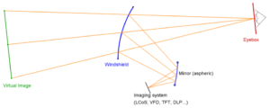
    A HUD is composed of an imager that generates an image (e.g. VFD, TFT, DLP…), and an optical part (a mirror in vast majority of systems), that will conjugate and project the image to a given distance. The projected image is said to be virtual, as it is seen by the driver as “floating in the air”.
    The following schematic shows the key parts of any windshield HUD: imager, freeform mirror and windshield:

    The optical systems, composed by complex shape surfaces, is designed in such a way that the orientation of the rays at the exit of the last optical surface (windshield in most cases) will force the eyes to accommodate on an image, placed at a long distance, hence the definition of virtual image. The virtual image could only be seen in an area called eyebox, limited due to different constrains (size of mirrors, size of system, requirement on brightness of the system…). The typical size of an eyebox is at least 130mmx60mm and is moved in height depending on the size of the driver (movement of ±60mm in most design).

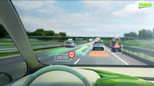
    But right now, those pieces of information are related to status of the vehicle or its close vicinity, e.g. proximity of an object in the blind spot area, but are not directly linked to the environment. So, a natural evolution of such a concept would be to correlate the virtual display with the real scene and the results of this fusion will give a direct and seamless information to the driver. Several examples come to mind to any reader:

    • highlight the road to be taken in relation with GPS with vibrant colors,
    • frame in real time a pedestrian crossing the street,
    • detect and display road signs or traffic lights,
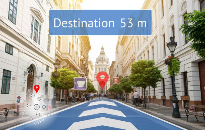
    • write content in relation with the environment named roads at a crossroad, possible parking lot, restaurants reviews…

    The figure below shows an artistic view of such concepts:

    This correlation to the real scene with a virtual image is often referred in the press or in the literature as Augmented Reality. Despite that the term of Augmented Reality could cover a larger span of applications depending on the fields (e.g. ref to “Le traité de la réalité virtuelle”, volume 1 – 5, Presses des Mines), the definition in the automotive field is rather straightforward: Display to the driver a virtual content superposed on the real scene, in real time.

    But the evolution from the day to day HUD, equipped in an increasing number of cars, to a truly augmented reality experience, is not just an upscaling from an existing technology. Some requirements are deeply redefined in the process and four of those main requirements will be exposed here:

    • Projection distance,
    • Field of View (FOV),
    • image position in space,
    • latency.

    Projection distance
    The projection distance is the distance between the driver’s eyes and the position of the virtual image. From another point of view, it’s the distance perceived by the driver to where the image is.
    This distance is chosen and fixed for each design, as it is still difficult both technically and financially to have a dynamic projection distance, for a mass production device.
    In a classical HUD design, ergonomic clues and feedback have suggested that the virtual image for a classical use should stay in the vicinity of the car. That’s why the virtual image is often put at the front end of the car’s hood. In the vast majority of cases, it is set to 2m, but a range between 1.5m to 2.5 is also a safe assumption.
    In an AR HUD design, this virtual image is put at a long distance in order to be better superposed the virtual content to the location of the actual cases, like highlighting cars, pedestrians, road signs… It is then chosen on average or depending on the use cases, and acceptable values could vary from 5m to 15m and more. This modification contributes to largely increase the complexity of the optic and mechanic (optomechanic): more power mirrors, higher sensibility in the assembly, increase in volume and weight…

    Field of view
    The size of the image is given by an angular description. The driver sees an image through 2 directions, i.e. the vertical Field Of View (FOV) and the horizontal FOV (see figure before).
    In the recent HUD world (end of 2017), the values are around 6°x2° (Horizontal x Vertical) and are evolving to 7°x2°, or even greater (the last Lincoln Continental has a 10°x2.5° at 2m projection distance). The vertical dimension is at the moment restricted by the current design of volume available under the dashboard and behind the cluster. To give an idea of the evolution of the image sizes, in 2014, the HUD displayed FOV of around 4.5°x2°, which will result a virtual image of 158mm x 70mm at 2m projection distance.
    For AR, the real scene is enriched with virtual data and therefore be ideally at the FOV of the human eye (or at least 20°x10°, cf. K.Bark, C.Tran, K.Fujimura, V.Ng-Thow-Hing. Personal navi: benefits of an augmented reality navigational aid using see-thru 3D volumetric HUD. AUI conference. 2014).
    At the moment, the requirement of the vast majority of use cases for an AR system is to have a FOV of 12°x4°. In the horizontal direction, the larger the FOV, the larger the portion of the road will be covered. In the vertical direction, it is directly linked to the portion of the road covered by the virtual image. In a 4°, the virtual image will cover the road from 15m to 80m. For even richer experience, it could be interested to highlight elements higher than the horizon line (e.g. road signs).

    Image position
    For any HUD, the driver needs to adjust the system to see a bright image. In the system itself, this adjustment is done through a kinematic system which will tilt a mechanical part of the system (majority of the time, it’s a mirror in the optical design). The consequence is that the virtual image will move according to this adjustment and it is seen higher on the road for a small driver and lower on the road for a tall driver. An analogy of a swing could be used: tall people need to receive the light coming from the system higher in the driver seat than smaller people and it forces the virtual image to go down. In the figure at the beginning showing a simplified HUD, the eyebox (on the right) of tall people needs to be moved upward (tall people are “higher” in the seat), and by consequence, the virtual image (on the left) moves downward. This aspect is not perceived by the drivers, as this adjustment is done once, and the virtual image has no connection with the road.
    In an AR system, the image, or at least the virtual content, has to stay fixed in space. Any movement of the virtual image involves wrong coincidence with the real scene, which results to a different experience between a small and a tall driver.
    To this regard, the image position in an AR HUD needs to be controlled, whereas it has never been an issue with traditional HUDs. This is a brand-new topic in regard with HUD design, such that an eyetracking system (or even an headtracking would be sufficient) could be mandatory in order to offer the best coincidence between virtual and reality contents while minimizing the error of superposition between these two, due to their difference of position in space (reminder: projection distance would be fixed at first). This later aspect is sometimes referred to parallaxes’ issues.

    Latency
    In virtual reality, in augmented reality or even in mixed reality with see-through glasses, the delay between the movement of the observer (head rotation, eye movement…) or the modification of the scene and the update of the virtual content in the virtual system must be extremely short. This delay is called latency.
    Studies suggest a maximum threshold at 20ms in the case of augmented reality, and also advise to not go upper 7ms in mixed reality, in the risk to experiment discomfort, discontinued stress, headache, and at the end, a rejection of the system by the user.
    Solutions to reduce latency are linked to the technology used and we don’t feel relevant to draw a long comprehensive list. The main idea is always to find tricks on the implementation and on the conception, in particular on the rendering engine or on the driver or on the hardware.


    Cues to the advantages of AR in Autonomous Conditions

    The autonomous car is clearly one of the biggest trend in the car world of the past couple of years, as seen in motor or consumer shows, and the potential of such a system is already tangible: increased safety and reduction in accident outcomes, traffic optimization with an increase of traffic flow, freeing the driver, and the list goes on and on.
    But before being at this dream stage of a full autonomous car, the experience of autonomous driving is currently categorized in levels with different possibilities. From level 0, where the driver is warned by the car but is still in control, to level 3, where the majority of the action is taken by the car, to level 5, where human assistance is seen as optional. At the moment, the car will obviously still require some assistance of the driver to overcome unknown situations (around level 2 to 4), and is sometimes referred to as cooperative driving mode. The car executes some defined actions (accelerate or brake, turning, etc) but requires the assistance of the driver to take some decisions (choosing the best lane, handle some key maneuvers).
    This is where Augmented Reality comes into play, as it will offer a set of tools for the driver to interact with the car, and for the car to communicate intelligible information to the driver.
    During the project Localisation and Augmented Reality, studied at IRT SystemX, use cases were studied in simulator and on a car equipped with an AR HUD prototype to define the correct visual grammar on the relevant objects of the environment. The following pictures show the tools or rendering used to study the link between autonomous driving and AR system, or the use cases of AR systems.

    IRT SystemX driving simulator setup: projection scene with car cockpit as close as possible as a real one: driving wheel and pedals, gear box and lever, simplified HUD composed of flat panel and PC monitor, safety belt, rear mirrors.
    Picture of a real scene with superposed virtual image generated by the AR windshield HUD system, embedded in a car, on a mannequin.

    During these studies, Augmented Reality appears to be a great asset to annotate the roads: highlight proximity cars or obstacles, and relative speed/distance to them, direction to be taken, key elements of the scene (pedestrians, traffic lights…).
    On another level, it is not uncommon to hear concerns about the autonomous car, in particular on a trust level: lack of confidence of consumers, fear of inefficiency or accidents.
    Again, a virtual image, collocated to the environment, will provide a complex and powerful communication pipe between the car and the driver. The different elements on the road, quoted before, will be highlighted by the AR system. The driver will know at any moment what the car understands about the environment and its vicinity and what decisions it is taking (merging in traffic, stopping because a danger has been identified…). The goal is to give the confidence to the driver that the car is able to handle the complexity of driving.
    For all the reasons exposed, it appears to us that autonomous driving and augmented reality are antagonist is a false assumption. At first, augmented reality could be a great asset for autonomous car, for both early adoption and integration to cooperative driving.


    Conclusion

    After many years of attempt in different fields (avionic, military, consumer market, automotive), there are nowadays many converging features that make it possible to integrate an Augmented Reality system in a car and have a convincing experience. Indeed, on the technical part, the emerging market of HUD in car affords to use luminous imagers at reasonable prices, even if some technical feats still need to be challenged or overcome.
    And on the software aspect, the smart detection devices, driven by the autonomous car market, are able of more and more recognition of objects in the driving scene.
    The user testings of Augmented Reality’s use cases were done in IRT SystemX through different approaches:

    • with a simulation cave (mockup cockpit with hemispheric projection screen),
    • with real devices, as AR head-up display prototype in a car (BMW X5).

    Simulation is a powerful tool that allows to establish the minimum and desired requirement of the applications, or to quickly debunk HMI ideas, behaviors of cars and drivers while controlling the experiments in safe conditions and having sharp elements to use and to compute (positions of simulated vehicles, working with low latency, etc). The studies conclude that AR HUD is a powerful system to pair with autonomous car, as it will help the driver to have a better understanding of the environment and to take over more easily the driving, when passing from autonomous to cooperative or non-autonomous mode.

  • Le rôle des Instituts de Recherche Technologique dans l’écosystème de la mobilité du futur

    Le rôle des Instituts de Recherche Technologique dans l’écosystème de la mobilité du futur

    Pour répondre aux enjeux de l’urbanisation croissante du monde et de la transition énergétique et environnementale, les mobilités de demain seront multimodales, à la demande, partagées, en grande partie autonomes et fortement connectées, à propulsion électrique pour une part significative, à faible impact environnemental. De nombreux défis technologiques, scientifiques, économiques, juridiques, d’usage, devront être relevés avant leur déploiement opérationnel à grande échelle à l’horizon 2030.

    La résolution de ces défis appelle les contributions et compétences d’une multiplicité d’acteurs que sont les fournisseurs de véhicules (automobiles, bus, tramway, trains, etc.), les fournisseurs de technologies (numérique, batteries, matériaux, infrastructures, etc.), les opérateurs de mobilité (privés, publics), les compagnies d’assurance, associées à celles de laboratoires de recherche académique et de start-up du domaine, très nombreuses et dynamiques.

    Les innovations qui donneront naissance à la mobilité de demain et aux nouveaux usages proviendront pour une part significative de l’interaction entre les différents acteurs de cet écosystème, interaction qui prendra notamment la forme de travaux de R&D, dont la couverture s’étend depuis la recherche amont en modélisation des mobilités, en science des données et outils d’optimisation et de recherche opérationnelle, jusqu’au développement et l’intégration des technologies dans des systèmes de plus en plus complexes. Par exemple, la sécurité et la sûreté de la mobilité de demain devra proposer des gains significatifs par rapport à l’état de l’art actuel, ce qui nécessitera des travaux de R&D associant approche scientifique et technologies de pointe, articulés avec les dimensions éthiques et juridiques.

    Les Instituts de Recherche Technologique (IRT) créés en 2012 dans le cadre des Investissements d’Avenir présentent la caractéristique d’associer la recherche de nature académique avec le développement et le transfert technologique propres aux entreprises, principalement en mode multilatéral, depuis la start-up jusqu’à la grande entreprise, en passant par l’ETI et la PME, de manière à maximiser les interactions et l’impact de compétitivité.

    Pour les pouvoirs publics, autorités organisatrices et financeurs des infrastructures, être associé aux travaux de R&D des IRT regroupant ses partenaires, sera un gage d’efficacité des expérimentations sur le terrain, essentielles à l’adaptation et la validation des innovations pour les territoires concernés.

    C’est ainsi qu’en tant que passerelle entre les différentes composantes de l’écosystème de la mobilité de demain et le monde des sciences et des technologies, les IRT occupent une place essentielle pour contribuer à l’invention et au déploiement de nouvelles solutions pour une mobilité propre et durable, flexible, et capable d’accompagner la croissance des besoins des acteurs socio-économiques, que ce soit les citoyens ou les entreprises.

    Cet article est extrait de livre blanc « RÉINVENTER LA MOBILITÉ URBAINE ET PÉRIURBAINE À L’HORIZON 2030 : 24 propositions pour l’Île-de-France dans le cadre de Paris 2024 ».

  • Sécurité numérique de la mobilité partagée, connectée et autonome : pour une nouvelle approche de la R&D

    Sécurité numérique de la mobilité partagée, connectée et autonome : pour une nouvelle approche de la R&D

    La mobilité partagée, connectée et bientôt autonome se construit autour de la coopération de systèmes d’information disparates opérés par des acteurs multiples grâce à l’hyperconnectivité de ses composantes (du smartphone aux moyens de transport eux-mêmes). La protection de ces systèmes d’information, des données qu’ils véhiculent et des services qu’ils offrent nécessite des arbitrages complexes entre la facilité d’usage, le coût et les gains attendus pour la sécurité, la sûreté de fonctionnement, le respect d’un droit numérique en évolution permanente et la compréhension et l’anticipation du marché et de ses acteurs. Trois axes complémentaires sont à privilégier dans une approche globale et interdisciplinaire — sciences mathématiques et informatiques, sciences économiques, sociales et du comportement — de la cyber sécurité : la protection des acteurs (industriels et utilisateurs finaux), la sécurisation des produits et services et le respect de la vie privée de l’usager.

    Une étude de terrain, menée par l’IRT SystemX auprès de TPE/PME victimes de cyber attaques (principalement rançongiciels et « fraudes au président ») a montré un taux d’attaques réussies ainsi qu’un préjudice humain largement sous-estimés. Des grandes entreprises ont vu également certaines de leurs usines ou filiales paralysées par des logiciels malveillants récents et évolutifs pour lesquels les contre-mesures s’avèrent difficiles en environnement contraint. Chaque entreprise devra à l’avenir former ses responsables et ses prestataires au cyber risque, mieux urbaniser ses systèmes d’information pour les rendre plus résistants, faire appel à des services de confiance et s’entraîner régulièrement à la gestion d’une crise cyber.

    La correction de la fragilité des systèmes industriels et des services est un sujet de recherche en soi. Les nouveaux produits et services de la mobilité en sont un exemple frappant et ceux-ci devront être sécurisés au plus tôt de leur conception. Les objets dits connectés, directement accessibles aux pirates, devront embarquer de nouvelles briques logicielles et matérielles immunes à des attaques dont l’outillage se partagera assurément. Et leur résilience nécessite de nouvelles approches. Des techniques de protection feront appel à des avancées dans la prévention (veille sur les menaces, analyses massives, simulations sur plateformes dédiées) et à des techniques de prédiction de défaillances par détection de signaux faibles (intelligence artificielle appliquée à la cybersécurité, filtrage et correction en temps réel, systèmes experts pour assister les opérateurs humains). Seule une mutualisation de la supervision et du traitement des incidents sera à même de gérer les nouveaux modes opératoires des attaquants bientôt, eux-mêmes, robotisés par les avancées de l’intelligence artificielle.

    La liberté de circulation est garantie par l’article 13 de la Déclaration universelle des droits de l’homme. La protection des données à caractère personnel et le respect de la vie privée sont aussi des droits fondamentaux majeurs dont le nouveau règlement européen sur la protection des données personnelles appuiera les principes centraux de consentement éclairé pour l’usager et de notification aux autorités de contrôle des failles pour les acteurs. Ce règlement, qui entrera en application le 25 mai 2018, introduit le concept du « privacy by design » qui appelle à des travaux de recherche novateurs. Il a été démontré que seules quatre informations spatio-temporelles de géolocalisation permettent d’identifier un individu avec une probabilité supérieure à 95% sur un territoire d’environ 80 000 personnes[1]. De nouvelles voies dont certaines relèvent encore de la recherche fondamentale sont donc à explorer : anonymisation, pseudonymisation, randomisation et protection de données personnelles différentielles. Elles feront appel à des briques technologiques encore peu usitées comme le chiffrement homomorphe, la signature de groupe, la preuve à divulgation nulle de connaissance, la communication anonyme, la recherche chiffrée dans les bases de connaissance. L’IRT SystemX, avec l’aide de ses partenaires, s’engage dans la voie de ces recherches de tout premier plan.

    [1] Yves-Alexandre de Montjoye, César A. Hidalgo, Michel Verleysen & Vincent D. Blondel (2013) Unique in the Crowd: The privacy bounds of human mobility, Nature Scientific Reports 3, 1376

    Cet article est extrait de livre blanc « RÉINVENTER LA MOBILITÉ URBAINE ET PÉRIURBAINE À L’HORIZON 2030 : 24 propositions pour l’Île-de-France dans le cadre de Paris 2024 ».

  • Smart Mobility: SystemX contributes to the future of mobility in Singapore

    Smart Mobility: SystemX contributes to the future of mobility in Singapore

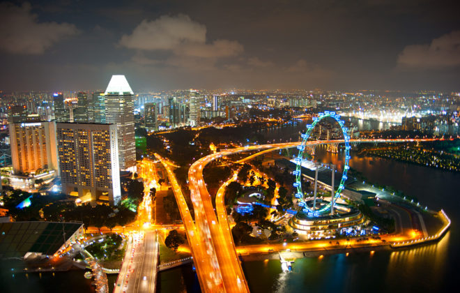
    In 2014, Singapore has launched its Smart Mobility 2030 program, dedicated to “moving towards a more connected and interactive land transport community”. Three years later, many initiatives have been rolled out across the Lion City. Here is a summary of this journey towards e-transport.
    The Institute for Research and Technology SystemX@Singapore, which as recently established itself in Singapore, is contributing to this effort by joining the CETRAN (Centre of Excellence for Testing & Research of AVs at NTU) project, aimed at testing and certifying the autonomous vehicles.

    Here is the problem statement to be solved: M. Tan lives in an island of 720 km², with a population of 5,6 million inhabitants, meaning a density close to 8,000 people/km², third most dense country in the world after Macau and Monaco. In the meantime, M. Tan and his fellow-citizens have built a 50 years old fast-growing economy (also 3d in the world by GDP/capita), that is likely to attract more and more people in the near future. Among these people are the elderly that will represent a bigger part of the whole population[1]. Altogether it means a confined land, packed with people, many of them with challenging mobility capacities, but most of them, including M. Tan, willing to take advantage of the new technologies enabling faster, easier and more convenient mobility. This is the problem statement Singapore has to face and solve in the coming years, so as many growing megacities. As part of the solution is the Smart Mobility 2030 strategic plan, issued in 2014 by the Singaporean government, providing the multiple keyplayers of this challenge with a roadmap.


    Smart Mobility 2030 Strategic Plan

    The so-called “Intelligent Transport System (ITS)” encompasses a wide range of solutions such as road networks optimisation, new public transport systems, incident management, as well as safety improvement. This has already led to the launch of the world’s first fully automated underground driverless Mass Rapid Transit line (MRT). E-payment with the Contactless e-Purse Application Standard (CePAS), the Electronic Road Pricing (ERP), or the Electronic Parking System (EPS) have also been instrumental in optimising people and vehicles’ traffic, hence reducing congestion.

    As for the future, connectivity and interactivity are keys to success. The travel experience will be composed of real-time information on-the-move, shared within the community, and beneficial for diverse groups of users including the elderly, the mobility-challenged, and the cyclists[2].

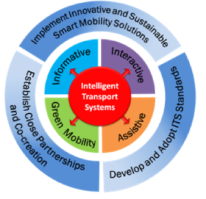
    The Smart Mobility 2030 roadmap relies on three strategies and four focal areas:

        LTA
    • 1st strategy: Implement innovative and sustainable smart mobility solutions
      Cost-effective solutions for diverse transport users and use of big data analytics to facilitate travel planning and management
    • 2d strategy: Develop and adopt ITS standards
      Need for accurate, shared, reliable, transport data, together with homogenised standards and protocols for ensuring inter-operability.
    • 3d strategy: Establish close partnerships and co-creation
      Foster public and private collaborations. Leverage on each other’s expertise and skills.

    To implement these strategies are the four focal areas:

    • Informative: Information on-the-go will become a “must have”, for a more mobile and more connected population. Data collection will rely on location systems (Global Navigation Satellite Systems), high definition video capture, as well as other means of sensor collection. Sensor deployment will have to minimize infrastructure impact while maximising data collection. Smart processing and algorithms will be key in facilitating the downstream data analysis. This huge amount of data will require appropriate technologies to manage big data and clear visualisation tools. Formats, interfaces, and protocols, will need to be harmonised, shared, and yet secured, as far as privacy and anonymity is concerned.
    • Interactive: Intelligent fleet management systems will become keys in many sectors as public buses (bus arrival times and load information), car-sharing on demand, smart logistics (faster goods delivery). Sharing of transport information between agencies, transport operators, emergencies, will lead to more effective and coordinated responses. Spatial and contextual information will be delivered to individuals and provide them with personalised content.
    • Assistive: In-vehicle on-board devices will provide warning information to drivers, thanks to for instance traffic light controls at traffic junctions. The development of V2V (Vehicle to Vehicle) and V2I (Vehicle to Infrastructure) technologies will also enable safety communication and reduce the number of accidents. These telematics applications should expand to dynamic routing, intelligent parking guidance, and real-time traffic news. A big part of this assistive future will rely on self-driving or autonomous vehicles. These driverless vehicles (cars, buses, trucks) will eliminate human errors, optimise road capacity, and lower carbon emissions. Nevertheless, in addition to technological issues, many regulatory obstacles will have to be overcome.
    • Green Mobility: Higher usage of public transport, “greener” vehicles (hybrid, electric), regenerative brakes in trains are examples of usages or technologies that reduce the impact on the environment. The development of new infrastructures for ITS equipment will require environmental-friendly conception, so as to minimize their own impact. Data centres use a lot of power and will require the optimisation of resource sharing through cloud computing or other solutions.


    Smart mobility initiatives in Singapore

    Today, in 2017, Singapore has rolled out many initiatives to address this 2030 agenda[3].

    For example, smarter bus systems, thanks to the Common Fleet Management System (CFMS), enable operators to monitor the location and performance of their bus fleets, and actively work with their bus captains to adjust bus operations in real-time.

    The Land and Transport Authority (LTA) is also developing a Fusion AnalyticS for public Transport Emergency Response (FASTER) system which will combine data from various sources, including fare-card, video and telecommunications systems, to perform analytics. It will enable LTA and the operators to visualise commuting patterns to improve transport planning, and it also triggers early alerts of crowd surges and transport incidents.

    The next-generation Electronic Road Pricing System, which is based on Global Navigation Satellite System technology, will enable the collection of comprehensive, real-time, aggregated traffic data, and disseminate such directly to motorists, to enable them to better plan and optimise their travel routes.

    The LTA has also been conducting trials of hybrid and electric buses. After promising first results, the objective is to run 50 hybrid and 60 electric buses, that is to say three bus services fully served by electric buses.

    As part of Singapore’s Electric Vehicle (EV) Phase 2 Test-bed, which aims to explore the viability of operating fleets of EVs for car-sharing and of electric taxis, LTA and the Economic Development Board (EDB) worked with HDT Singapore Taxis Pte Ltd to bring in Singapore’s first fully-electric taxi fleet. HDT began operating its fully-electric taxi service in September 2016, and progressively deploys 100 e-taxis by mid-2017 as part of an eight-year trial.

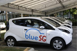
    LTA and EDB partnered BlueSG Pte Ltd to launch the BlueSG EV car-sharing programme, which will see 1,000 shared EVs deployed across all HDB towns by 2020, and the installation of 2,000 charging points island-wide. The first batch of 125 Bluecars and 250 charging points will be rolled out by the second half of 2017.

    BlueSG

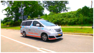
    Lastly, a lot of efforts have been made in the field of autonomous vehicles. For about 2 years, many trials have started across the country. In September 2016, LTA doubled the length of the test routes within One-North from 6 to 12km, after AV trial participants showed their capabilities in navigating mixed traffic environments. Since then, the AV trial participants have demonstrated a readiness to advance their capabilities to more on-road scenarios in an expanded test area. In June 2017, new areas such as the National University of Singapore (NUS), Singapore Science Park 1 and 2, Dover and Buena Vista, have been opened to AVs trials. These areas present a larger test bed, and will add another 55km to the existing AV trial routes.


    Autonomous trials in Singapore in 2017[4]

    • A*STAR’s Institute for Infocomm Research (I2R): first self-driving vehicle to be approved for public road testing at One-North since July 2015.
    A*STAR
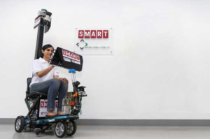
    • National University of Singapore (NUS) and the Singapore-MIT Alliance for Research and Technology (SMART): testing a fleet of self-driving golf-buggies. A retrofitted electric passenger car was the second vehicle to be approved for more complex testing on public roads. A prototype of a four-wheel self-driving Personal Mobility Device was also unveiled for public trial in November 2016.
    SMART
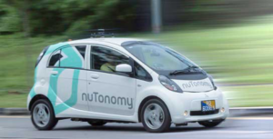
    • Delphi automotive and nuTonomy: the first private company – and the third applicant – to obtain approval for public road testing at One-North as of April 2016. Aim to launch a commercial autonomous mobility-on-demand service.
    nuTonomy
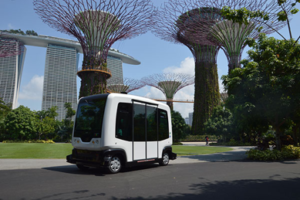
    • Gardens by the Bay, French company EasyMile in collaboration with ST Engineering: the EasyMile driverless shuttle went for public trial in December 2015 and is now in service at Gardens by the Bay. On 22 June 2016, Gardens by the Bay launched the Auto Rider for public rides.
    EasyMile
    • French company Navy, in collaboration with Energy Research Institute (ERI@N) at Nanyang Technological University (NTU): self-driving golf cart and electric shuttle around NTU can fetch up to 8 people and travel at a maximum speed of 20 km/h. These are part of NTU’s plans to eventually trial two full-sized autonomous bus in its campus in 2018.
    LTA, NTU
    • LTA and ST Kinetics: development of a 40-seater electric autonomous bus prototype.
    • MOT (Ministry of Transports) and PSA Corporation collaboration with Scania and Toyota: truck platooning trials over a three-year period from January 2017 to December 2019, the collaboration will enable heavy vehicles to move in leader-follower formation, as well as to fully automate the processes for precise docking and undocking of cargo.
    • Katoen Natie and VDL: 12 driverless trucks will go on trial on Jurong Island from September 2017. The trucks will be retrofitted with autonomous systems which will communicate with transponders installed in the road.


    In order to allow these autonomous vehicles to join the road traffic, government authorities like LTA will need to assess, test, and certify them so as to ensure the maximum of safety and convenience for road users. This is the scope of the Centre of Excellence for Testing & Research of AVs at NTU, namely the CETRAN project.

    What is CETRAN?

    The Land Transport Authority (LTA) and JTC (Jurong Town Corporation), in partnership with the Nanyang Technological University (NTU), launched CETRAN, at CleanTech Park on August 2016. On November 22d, 2017 the CETRAN circuit will be officially opened by the Singaporean Minister of Transport, M. Khaw Boon Wan.

    JTC

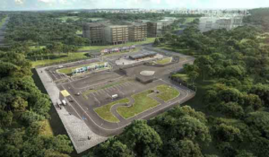
    CETRAN will spearhead the development of testing requirements for SDVs, for which testing will be carried out at the 1.8-ha CETRAN Test Circuit, which is jointly developed by LTA and JTC to provide industry players with a simulated road environment for the testing AVs prior to their deployment on public roads.

    In line with LTA strategy to establish public and private collaborations, NTU is partnering with four foreign entities to develop the CETRAN project. BMW, TNO, TUV-SUD, and SystemX will be each responsible for one workpackage of the project.

    The workpackage managed by SystemX will focus on digital modelling & simulation for safety & digital security, applied to autonomous transport. This is the first project of SystemX in Singapore, willing to develop others in the coming months, in the fields of autonomous transports, agile industry, smart territories, or internet of trust.


    [1] http://www.singstat.gov.sg/statistics/visualising-data/storyboards/population-trends

    [2] https://www.lta.gov.sg/content/dam/ltaweb/corp/RoadsMotoring/files/SmartMobility2030.pdf

    [3] https://www.lta.gov.sg/apps/news/page.aspx?c=2&id=e09102cd-acd5-469e-8234-777b68e4e18a

    [4] https://www.smartnation.sg/initiatives/Mobility/self-driving-vehicles-sdvs-future-of-mobility-in-singapore